- Home
- Shop Books
- New Releases
- Best Sellers
- Adult Fiction
- Adult Non Fiction
- Accounting, Economics & Finance
- Agriculture & Farming
- Animals & Wildlife
- Antiques & Collectables
- Architecture
- Art & Design / Artists & Art Works
- Autobio, Biographies & Memoirs
- Boating / Marine
- Building, Construction, DIY
- Business & Management
- Computer & Information Software
- Cooking, Food & Beverages
- Crafts, Hobbies, Games & Quizzes
- Dictionaries & Thesauri
- Education / Educational Teaching
- Educational / Learning Readers
- English Language Teaching - ELT
- Enviro, Conservation & Nature
- Family & Relationships
- Fashion & Lifestyle
- Finance & Investment
- Gardening
- General Non-Fiction
- Geography
- Graphic Novels
- Health & Fitness
- History
- Humour
- Interior Design
- LGBTQIA+
- Languages
- Law & Legal
- Literature, Anthologies & Poetry
- Medicine & Medical
- Military & Warfare
- Music / Musical Instruments
- Natural History
- New Age / Mind / Body / Spirit
- Philosophy
- Photography & Pictorials
- Political & Economics
- Psychology
- Reference - Annuals & Serials
- Religion & Religious Studies
- Science, Maths & Technology
- Self Help & Personal Management
- Society & Culture / Ethnic Studies
- Sports & Outdoor Recreation
- Stationery, Gift & Misc Items
- The Arts
- Transportation
- Travel
- True Crime & True Stories
- TV, Radio, Film & Theatre
- Children's Fiction
- Adventure Stories
- Animal Stories
- Baby, Touch & Feel
- Classics & Vintage
- Crime & Mystery
- Educational & Learning Readers
- Fairy Tale & Nursery Rhyme
- Fantasy & Magical Realism
- General Fiction
- Graphic Novels
- Historical
- Horror & Ghost
- Humorous Stories
- LGBTQIA+
- Maori, NZ & Pasifika
- Picture Storybooks
- Pop-up, Interactive & Activity
- Romance, Relationships & Family
- School & Sporting
- Sci-fi
- Short Stories
- Thriller & Suspense
- Children's Non Fiction
- Animals & Wildlife
- Atlases & Encyclopedias
- Autobio, Biographies & Memoirs
- Computer & Information Software
- Cooking, Food & Beverages
- Crafts, Hobbies, Games & Quizzes
- Dictionaries, Thesauri & Reference
- Early Learning & Learning Concepts
- Educational / Learning Readers
- English Language Teaching - ELT
- Environment & Conservation
- Gardening
- General Knowledge & Trivia
- General Non-Fiction
- Geography
- Graphic Novels
- Health & Fitness
- History
- Humour
- Languages
- LGBTQIA+
- Literature, Anthologies & Poetry
- Maori, NZ & Pasifika
- Military & Warfare
- Music
- Nature, Prehistoric World
- People & Places, Work & Industry
- Personal & Social Issues
- Pop-up, Lift-the-flap, Activity
- Religion & Religious Studies
- Science, Maths & Technology
- Sports & Outdoor Recreation
- Stationery, Gift & Misc
- Transportation
- True Stories
- TV, Radio, Film & Theatre
- Young Adult Fiction
- Young Adult Non Fiction
- Animals & Wildlife
- Autobio, Biographies & Memoirs
- Computer & Information Software
- Cooking, Food & Beverages
- Crafts, Hobbies, Games & Quizzes
- Dictionaries, Thesauri & Reference
- Educational / Learning Readers
- English Language Teaching - ELT
- General Knowledge & Trivia
- General Non-Fiction
- Geography
- Graphic Novels
- Health & Fitness
- History
- Humour
- LGBTQIA+
- Languages
- Literature, Anthologies & Poetry
- Maori, NZ & Pasifika
- Military & Warfare
- Music
- Nature, Prehistoric World
- People & Places, Work & Industry
- Personal & Social Issues
- Religion & Religious Studies
- Science, Maths & Technology
- Sports & Outdoor Recreation
- True Stories
- TV, Radio, Film & Theatre
- NZ Authors & Self Published
- University TextBooks
- Clearance Books
- T & C's
- Contact Us

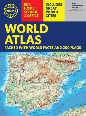
Philip's World Atlas #: Philip's RGS World Atlas (A4)
>Home >Shop Books >Adult Non Fiction >Reference - Annuals & Serials >Philip's World Atlas #: Philip's RGS World Atlas (A4)
with Global Cities, Facts and Flags
- Blurb -
The highest peak? The deepest ocean trench? The wettest, driest, longest, largest - we list the world' s fascinating extremes. Alongside the topography and physical attributes of the earth we also show political boundaries and the great global cities, including transport hubs and places of interest from mosques to temples, palaces to zoos and shopping centres to tourist information centres. Crammed with practical information like a Distance Chart for World Cities, World Time Zones, over 200 State Flags and the top 100 most populous countries, we include around 15,000 places indexed for easy checking. Whether for the pub quiz, travel planning or school reference, this great value handy world atlas is crammed with everything you need to know. Features include: * 200 Flags of the world' s major states and territories * 21 City centre maps: transport (road, rail, trams, light railways, bus and railway stations) and places of interest including religious buildings (churches, abbeys, cathedrals, synagogues, shrines, temples, mosques), museums, galleries, theatres, palaces, castles, parks, gardens, zoos, shopping centres, hospitals, Tourist Centres. * World city distance table * World time zones map * World country comparisons table - the population and areas of the world' s top 100 most populous countries * World physical comparisons- largest oceans, longest rivers, biggest islands, highest peaks, deepest trenches. * Continental Comparator - for each one we show area, coldest place, hottest place, wettest place, driest place * World topographic maps - with coloured contour layers and hill-shading clearly outlining the Earth' s surface. * World political maps - the latest boundary and geopolitical changes, with cities, provinces and countries shown. * Index of around 15,000 place-names - with geographical features like mountains, lakes and deserts, as well as towns.- Titles in the Series -
Philip's RGS Atlas of the World
Philip's RGS Atlas of the World
Philip's RGS Children's School Atlas
Philip's RGS Complete World Atlas
Philip's RGS Essential School Atlas
Philip's RGS Infant School Atlas: For 5-7 Year Olds
Philip's RGS Junior School Atlas
Philip's RGS Modern School Atlas
Philip's RGS World Atlas
Philip's RGS World Atlas (A4): with Global Cities, Facts and Flags
- Author Bio -
Philip' s has been at the forefront of creating maps and atlases since 1834. Whether a local street map or a fact-packed World Atlas, we use the most up-to-date technology, expertise and our global network to ensure our customers have all the information they need.- Full Details -
| Status: | No local stock, title imported to order |
| ISBN-13: | 9781849075916 |
| Published: | 3 Mar 2022 |
| Published In: | United Kingdom |
| Imprint: | Philip's |
| Publisher: | Octopus Publishing Group |
| Format: | Paperback |
| Height: | 308mm |
| Width: | 228mm |
| Spine: | 8mm |
| Weight: | 340g |
| Pages: | 64 |
- Delivery ETA -
In stock - for items in stock we aim to dispatch the next business day. For delivery in NZ allow 2-5 business days, with rural taking a wee bit longer.
Locally sourced in NZ - stock comes from a NZ supplier with an approximate delivery of 7-15 business days.
International Imports - stock is imported into NZ, depending on air or sea shipping option from the international supplier stock can take 10-30 working days to arrive into NZ.
Pre-order Titles - delivery will vary depending on where the title is published, if local stock is available in NZ then 5-7 business days, for international imports it can be 10-30 business days. In all cases we will access the quickest supply option.
Delivery Packaging - we ship all items in cardboard sleeves or by box with either packing paper or corn starch chips. (We avoid using plastics bubble bags)
Tracking - Orders are delivered by track and trace courier and are fully insured, tracking information will be sent by email once dispatched.
 |
|
© Copyright 2024 AllBooks.NZ |