- Home
- Shop Books
- New Releases
- Best Sellers
- Adult Fiction
- Adult Non Fiction
- Accounting, Economics & Finance
- Agriculture & Farming
- Animals & Wildlife
- Antiques & Collectables
- Architecture
- Art & Design / Artists & Art Works
- Autobio, Biographies & Memoirs
- Boating / Marine
- Building, Construction, DIY
- Business & Management
- Computer & Information Software
- Cooking, Food & Beverages
- Crafts, Hobbies, Games & Quizzes
- Dictionaries & Thesauri
- Education / Educational Teaching
- Educational / Learning Readers
- English Language Teaching - ELT
- Enviro, Conservation & Nature
- Family & Relationships
- Fashion & Lifestyle
- Finance & Investment
- Gardening
- General Non-Fiction
- Geography
- Graphic Novels
- Health & Fitness
- History
- Humour
- Interior Design
- LGBTQIA+
- Languages
- Law & Legal
- Literature, Anthologies & Poetry
- Medicine & Medical
- Military & Warfare
- Music / Musical Instruments
- Natural History
- New Age / Mind / Body / Spirit
- Philosophy
- Photography & Pictorials
- Political & Economics
- Psychology
- Reference - Annuals & Serials
- Religion & Religious Studies
- Science, Maths & Technology
- Self Help & Personal Management
- Society & Culture / Ethnic Studies
- Sports & Outdoor Recreation
- Stationery, Gift & Misc Items
- The Arts
- Transportation
- Travel
- True Crime & True Stories
- TV, Radio, Film & Theatre
- Children's Fiction
- Adventure Stories
- Animal Stories
- Baby, Touch & Feel
- Classics & Vintage
- Crime & Mystery
- Educational & Learning Readers
- Fairy Tale & Nursery Rhyme
- Fantasy & Magical Realism
- General Fiction
- Graphic Novels
- Historical
- Horror & Ghost
- Humorous Stories
- LGBTQIA+
- Maori, NZ & Pasifika
- Picture Storybooks
- Pop-up, Interactive & Activity
- Romance, Relationships & Family
- School & Sporting
- Sci-fi
- Short Stories
- Thriller & Suspense
- Children's Non Fiction
- Animals & Wildlife
- Atlases & Encyclopedias
- Autobio, Biographies & Memoirs
- Computer & Information Software
- Cooking, Food & Beverages
- Crafts, Hobbies, Games & Quizzes
- Dictionaries, Thesauri & Reference
- Early Learning & Learning Concepts
- Educational / Learning Readers
- English Language Teaching - ELT
- Environment & Conservation
- Gardening
- General Knowledge & Trivia
- General Non-Fiction
- Geography
- Graphic Novels
- Health & Fitness
- History
- Humour
- Languages
- LGBTQIA+
- Literature, Anthologies & Poetry
- Maori, NZ & Pasifika
- Military & Warfare
- Music
- Nature, Prehistoric World
- People & Places, Work & Industry
- Personal & Social Issues
- Pop-up, Lift-the-flap, Activity
- Religion & Religious Studies
- Science, Maths & Technology
- Sports & Outdoor Recreation
- Stationery, Gift & Misc
- Transportation
- True Stories
- TV, Radio, Film & Theatre
- Young Adult Fiction
- Young Adult Non Fiction
- Animals & Wildlife
- Autobio, Biographies & Memoirs
- Computer & Information Software
- Cooking, Food & Beverages
- Crafts, Hobbies, Games & Quizzes
- Dictionaries, Thesauri & Reference
- Educational / Learning Readers
- English Language Teaching - ELT
- General Knowledge & Trivia
- General Non-Fiction
- Geography
- Graphic Novels
- Health & Fitness
- History
- Humour
- LGBTQIA+
- Languages
- Literature, Anthologies & Poetry
- Maori, NZ & Pasifika
- Military & Warfare
- Music
- Nature, Prehistoric World
- People & Places, Work & Industry
- Personal & Social Issues
- Religion & Religious Studies
- Science, Maths & Technology
- Sports & Outdoor Recreation
- True Stories
- TV, Radio, Film & Theatre
- NZ Authors & Self Published
- University TextBooks
- Clearance Books
- T & C's
- Contact Us

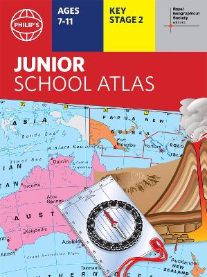
Philip's World Atlas #: Philip's RGS Junior School Atlas
>Home >Shop Books >Children's Non Fiction >Atlases & Encyclopedias >Philip's World Atlas #: Philip's RGS Junior School Atlas
Click to view other formats:
9781849075794 UK Hardback $19.99
- Blurb -
The 11th edition of the market-leading atlas for primary school pupils, Philip' s RGS Junior School Atlas has been fully revised and updated with all the latest facts and curriculum requirements. - The essential atlas for primary schools with clear and easy-to-follow maps and diagrams - updated for 2021/2022- Published in association with the Royal Geographical Society- Recommended for Key Stage 2 of the National Curriculum - and all 7-11 year olds - An excellent introduction to mapping concepts such as scale, direction, symbols, longitude and latitude- 22-page Britain and Ireland section with clear thematic charts, diagrams and large-scale regional maps- 22-page section on The World, with political maps - and thematic treatment of key themes, from volcanoes and earthquakes to transport and tourism- Continents section with physical and political maps- Easy-to-follow map references and 1,000-place indexThe market-leading atlas for pupils at primary schools, Philip' s RGS Junior School Atlas is a stimulating and authoritative first introduction to the world of maps, and is recommended for Key Stage 2 of the National Curriculum. The introductory section describes the meaning of scale, how to measure distances using the maps, and explains the symbols on the maps. The following section is devoted to the United Kingdom and Ireland. Thematic maps cover topics such as mountains and rivers, climate and weather, population and cities, farming and fishing, industry and energy, transport, tourism and conservation. Regional maps of England and Wales, Scotland and Ireland complete this section. The rest of the atlas is made up of world thematic maps and world continental maps. Included are topics such as the world' s climate, vegetation, agriculture, energy sources, and environmental concerns, such as global warming. A simple letter-figure index completes the atlas - a useful introduction to help the young reader find his/her way around the maps. Available in both Hardback and Paperback editions.- Titles in the Series -
Philip's RGS Atlas of the World
Philip's RGS Atlas of the World
Philip's RGS Children's School Atlas
Philip's RGS Complete World Atlas
Philip's RGS Essential School Atlas
Philip's RGS Infant School Atlas: For 5-7 Year Olds
Philip's RGS Junior School Atlas
Philip's RGS Modern School Atlas
Philip's RGS World Atlas
Philip's RGS World Atlas (A4): with Global Cities, Facts and Flags
- Author Bio -
Philip' s has been at the forefront of creating maps and atlases since 1834. Whether a local street map or a fact-packed World Atlas, we use the most up-to-date technology, expertise and our global network to ensure our customers have all the information they need.- Full Details -
| Status: | Indent title, imported to order |
| ISBN-13: | 9781849075800 |
| Published: | 27 Oct 2021 |
| Published In: | United Kingdom |
| Imprint: | Philip's |
| Publisher: | Octopus Publishing Group |
| Format: | Paperback |
| Height: | 298mm |
| Width: | 222mm |
| Spine: | 6mm |
| Weight: | 300g |
| Pages: |
- Delivery ETA -
In stock - for items in stock we aim to dispatch the next business day. For delivery in NZ allow 2-5 business days, with rural taking a wee bit longer.
Locally sourced in NZ - stock comes from a NZ supplier with an approximate delivery of 7-15 business days.
International Imports - stock is imported into NZ, depending on air or sea shipping option from the international supplier stock can take 10-30 working days to arrive into NZ.
Pre-order Titles - delivery will vary depending on where the title is published, if local stock is available in NZ then 5-7 business days, for international imports it can be 10-30 business days. In all cases we will access the quickest supply option.
Delivery Packaging - we ship all items in cardboard sleeves or by box with either packing paper or corn starch chips. (We avoid using plastics bubble bags)
Tracking - Orders are delivered by track and trace courier and are fully insured, tracking information will be sent by email once dispatched.
 |
|
© Copyright 2024 AllBooks.NZ |